
Not only art, history and culture. Vienna is the ideal destination as well for those who want to relax surrounded by unspoiled nature.
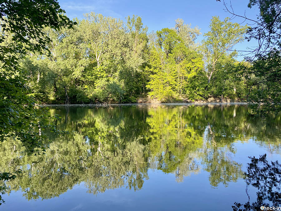
This is because the Austrian capital lies in the heart of the Wienerwald, a vast green area that was declared a UNESCO Biosphere Reserve in 2005. In addition to protected animal and natural species, this area is home to numerous vineyards that make Vienna the only metropolis in the world that can boast of significant wine production.
The city’s wine can be tasted in Heurigen, traditional wine bars scattered throughout the various hamlets located on the outskirts of the city such as Nußdorf, Grinzing and Neustift.
Three urban walks to do in Vienna
The itineraries shown in this article are just a few of those available while staying in the city. I hope to add more on future trips.
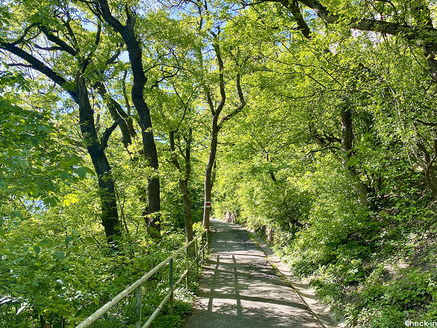
These urban trails are called Stadtwanderweg and each has its own identification number. The directions are clear and the routes are often also available on websites such as Wikiloc and Komoot.
As I will explain later, the walks described in points 2) and 3) can be combined into a single route. Furthermore, in both cases, the excursion can be shortened by taking the 38a bus.
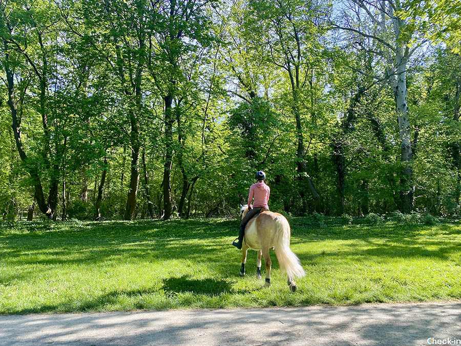
1) Prater park, away from the tourists
The first excursion I took followed route no. 9, leading me to discover Vienna’s most famous park.
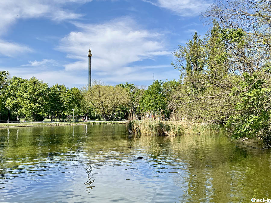
Known by everyone for the Ferris wheel and its other 250 attractions, few realize that the famous amusement park actually occupies a minimal portion of this green area.
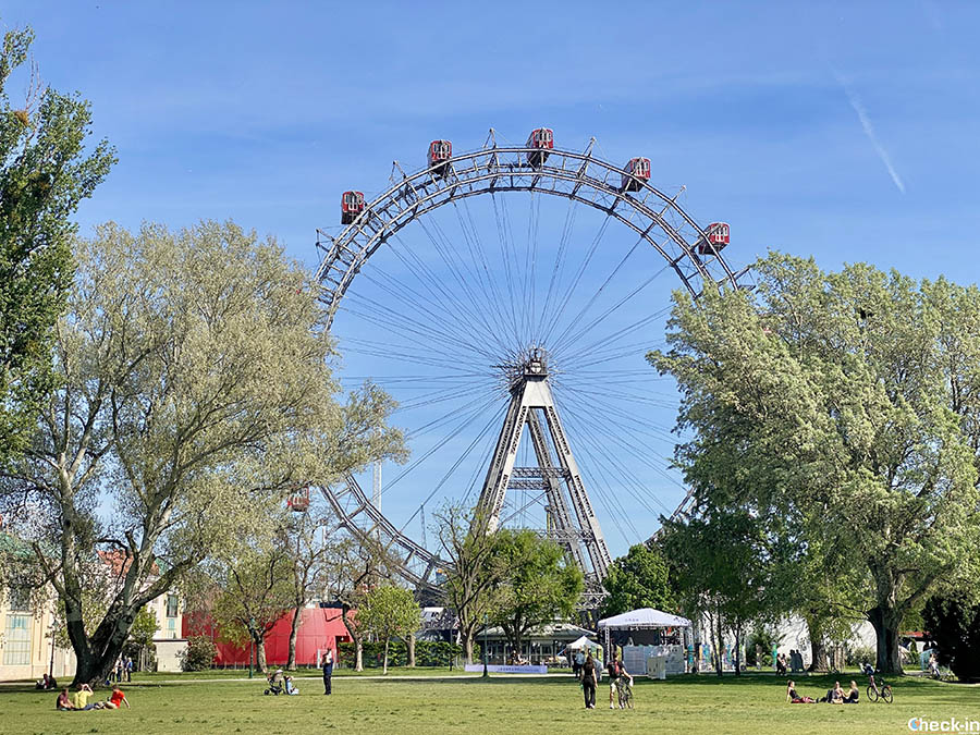
Just a few hundred meters away, you find yourself surrounded by wide meadows, picnic areas, woods, and streams. You encounter cyclists, people on horseback, walking, and jogging.
The Stadtwanderweg 9 is an itinerary of about 13 km that takes 3-4 hours to complete. There are no difficulties, making it a hike suitable for the whole family. Signage is always present, especially near junctions. It also happens to find some secondary detours, but they usually reconnect almost immediately to the main path.
The starting/ending point is near the Ferris wheel, from where you then need to enter the Hauptallee. This is the main avenue that with its 4.5 km length crosses the Prater from one side to the other up to the Cafe-Restaurant Lusthaus.
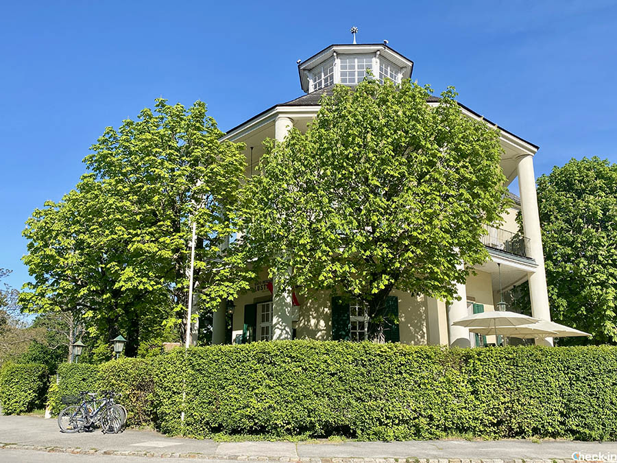
When you reach this establishment you are approximately halfway through the loop, and after walking along the southern side of the park, you switch to the northern side facing the Danube.
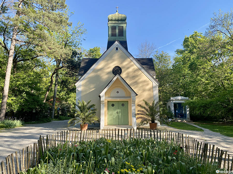
Among the points of interest along the route, I point out the spherical dwelling included in the territory of the “Republic of Kugelmugel” (it is one of the unusual places in Vienna I mentioned in this article) and the Church of Maria Grün built in 1924, a popular pilgrimage destination.
To reach the starting point of the walk, you need to get off at the “Praterstern” stop (U1-U2 subway).
2) From Nußdorf to Kahlenberg
It’s the classic Viennese day trip because it’s easily accessible – even for cyclists – and, once on top of Kahlenberg, you have a complete view over the Austrian capital. The good news is that you can also comfortably climb up here by bus 😉
Furthermore, as I will explain later it’s a hike that can be connected to a second itinerary that includes another panoramic hill with a final descent towards the cycle path along the Danube.
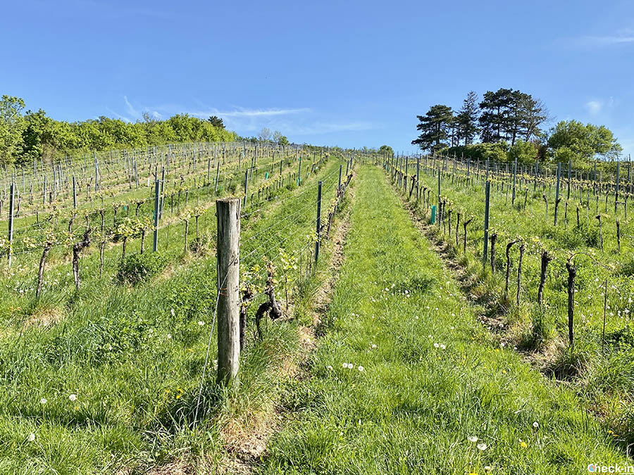
The Stadtwanderweg 1 is a simple walk that winds through some of the vineyards of the Wienerwald starting from Nußdorf, a historic village now incorporated into the Austrian metropolis. In addition to wine, this area is famous for Ludwig van Beethoven.
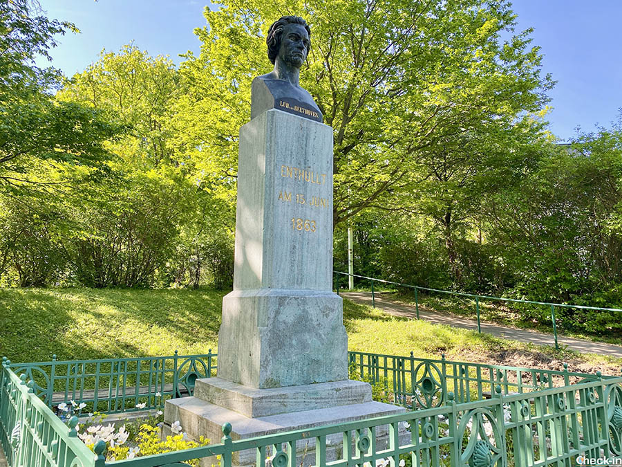
More or less halfway between Grinzing and Nußdorf is the house where the German composer lived to be able to go to the thermal baths of nearby Heiligenstadt. It was the last, desperate and unfortunately useless attempt to avoid deafness.
The result of this experience was the famous Heiligenstadt Testament, a historical document in which the musician recounted his dramatic situation with the consequent need to progressively isolate himself from society. In the building of that time, the Beethoven Museum has been set up today.
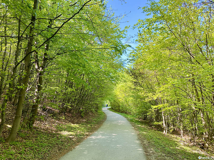
The first section of the route follows the Beethovengang, which was the composer’s favorite walk, which partly borders the Schreiberbach stream. Leaving the last residential buildings behind, the path gradually gains altitude, bordering a series of vineyards before entering the woods.
Just before reaching the top of Kahlenberg (484 m above sea level), you come out onto a path that runs parallel to the one used by cars and urban buses.
This leads to the foot of the viewpoint “Stefaniewarte“, the highest point of the Stadtwanderweg. 1. The observatory, open in late spring-summer and accessible for free, with its 22 m height offers a comprehensive view of Vienna as well as the Danube valley and the Wienerwald.
The building was erected in 1887 and is named after Princess Stefania of Belgium, wife of the heir apparent Rudolf of Habsburg-Lorena, who later committed suicide in Mayerling in 1889.
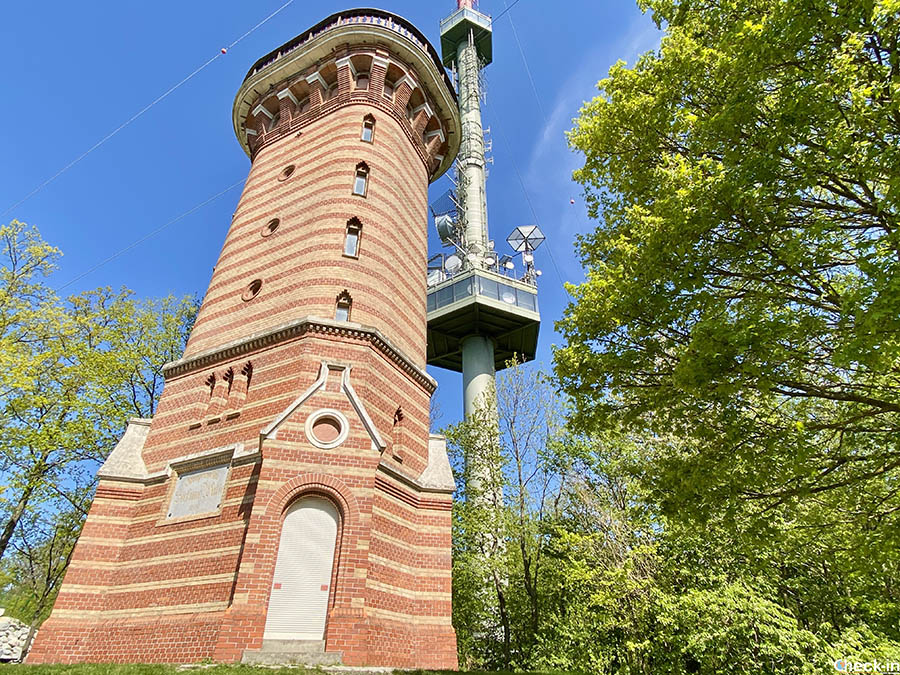
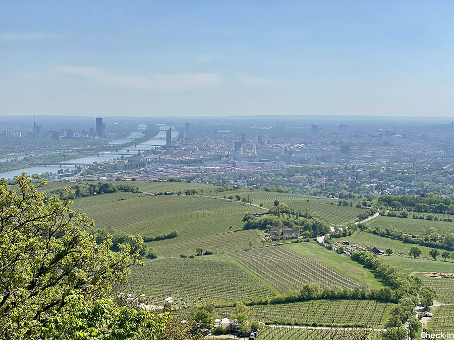
Just below the summit is the recreational area with ample parking, a souvenir shop, public restrooms, a bus stop, cafes, the Kahlenberg bar-restaurant, and the nearby panoramic terrace overlooking the Austrian metropolis.
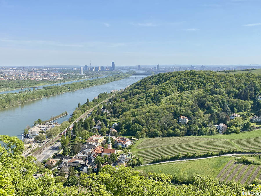
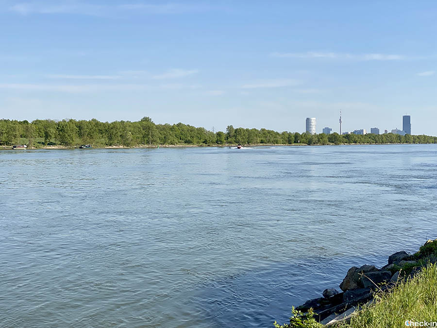
From here, you can easily spot historic buildings such as St. Stephen’s Cathedral and the Prater Wheel, as well as symbols of modernity like the DC Tower and the Millennium Tower.
From Nußdorf to the top of the hill it took me roughly 2h 30m.
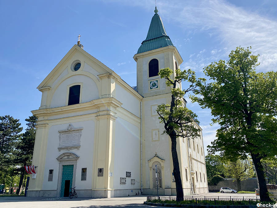
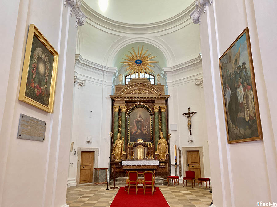
The place of greatest interest is the Church of St. Joseph, a Baroque temple commemorating the most important historical event that happened in this area. In 1683 the King of Poland Sobiesky led his troops on Kahlenberg, freeing Vienna from the siege of the Turks.
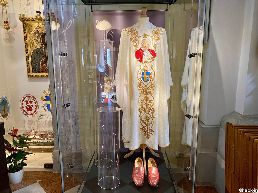
A case inside the building holds the chasuble of Pope John Paul II, who on September 13, 1983, ascended this hill on the occasion of the 300th anniversary of the defeat of the Ottoman army.
Route no. 1 continues by crossing the parking lot for cars and tourist buses before entering a paved path. It first passes the Elisabethwiese, a green area ideal for picnics, and then the Josephinenhütte tavern. The establishment is located at the entrance to the Kahlenberg adventure park, with equipped paths for children.
Then you come to a crossing point: to complete route no. 1 you must descend to the right; otherwise, you can continue straight along variant 1a.
3) From Leopoldsberg to Kahlenbergerdorf and back to Nußdorf
Urban hiking trail 1a is a recently added route and it can be integrated with route 1 to create a more complete loop of the area.
In fact, by ignoring the junction sign a few lines above, you arrive in just over 10 minutes near the top of Leopoldsberg hill, at 425 m altitude, dominated by the Church of Saint Leopold.
The current church, which was reopened in 2018, has a long and troubled history that begins in the 12th century, when Count Leopold III of Babenberg had a fortress built, the foundations of which are still preserved today.
The original chapel was destroyed, rebuilt, and destroyed again following the two sieges of Vienna (1529 and 1683) by the Turks. It was finally consecrated in 1693. This story is accompanied by another, more particular one, concerning the names of the two adjacent hills.
In fact, the Kahlenberg hill took its current name during that period, as it was previously known as Sauberg. Similarly, the current Leopoldsberg was renamed instead of Kahlenberg, as it had always been called.
The hill, less known and frequented than its “sister”, is a suggestive natural viewpoint over the Danube Valley and the city of Vienna, especially its modern urban area.
When it’s time to descend I follow the 1.5 Km Nasenweg path. The slope is quite steep, especially compared to the one faced up to that point.
I must say that the decision to go uphill was the best one, considering it was a hot sunny day!
After almost one hour’s walk a final staircase leads me to Kahlenbergerdorf, a village with a long winemaking tradition and now integrated into the Austrian metropolis. I enter the railway underpass that leads to the cycle path along the Danube, which I follow for a couple of kilometers, finally arriving in Nußdorf.
Urban Trekking from Vienna City Center: practical information
These three walking itineraries are easy, especially the Prater route which is suitable for the whole family and offers benches and picnic areas along the way.
The climb to Kahlenberg and descent from Leopoldsberg do not present any significant difficulties but still require a minimum level of training.
These are hikes possible all year round, even if for routes 2–3 autumn is recommended to visit Vienna’s vineyards. Given the modest elevations, I would not suggest them on the hottest summer days.
Good news for those who don’t want to walk: both hills are conveniently accessible by bus. Line 38A departs from Heiligenstadt railway station and takes about 25 minutes up to Kahlenberg and an additional 2-3 minutes to reach Leopoldsberg. The service operates 7 days a week with an average of one trip every 10 minutes to/from Kahlenberg and every 30 minutes to/from Leopoldsberg.
To reach the trailhead in Nußdorf, you must take tram D from Vienna’s city center with stops at Central Station (Hauptbahnhof), Upper Belvedere (Schloss Belvedere), City Hall (Rathausplatz/Burgtheater) and Schottentor. The final stop is Nußdorf Beethovengang, just a few dozen meters from the starting point of route 1.
For more information on timetables and ticket prices, have a look at the Wiener Linien website. Google Maps is also good for real-time departures.
In this case, in addition to multi-day passes, I remind you that public transport is included with the Vienna City Card. This is a tourist card valid for 24, 48, 72 hours or 7 days that also allows you to visit city attractions at reduced prices. I explain how it works in this article of the blog.
Finally, the City of Vienna website you find the list of all urban walks with routes and maps.